Green Circle Trail
Bikers on the Green Circle Trail, Photo courtesy of Stevens Point CVB
The Green Circle Trail is a 26-mile hiking and biking trail that loops throughout the City of Stevens Point and surrounding areas. The main loop of the Green Circle is made up of 12 connecting trail segments. All urban residents are within 10 minutes of the Trail system! It links Pfiffner, Pioneer, Bukolt, Zenoff, Yulga, Whitetail, Hein, Iverson, Plover River and Parkwood parks in Stevens Point, the villages of Whiting and Plover and town of Hull with other publicly owned lands, such as the University of Wisconsin-Stevens Point’s (UWSP) Schmeeckle Reserve and the city’s wooded well field. It follows both the Wisconsin and Plover rivers. The Trail preserves and protects the area’s forested land, plants, wetlands, and wildlife.
The Trail is intended for use by all ages and ability levels. UWSP and local schools use the Trail as a resource for recreation and education. Children can cross the Plover River footbridge as a short-cut to school. A Wisconsin Central Railroad underpass on the city’s east side provides a safe, legal crossing for walkers and bikers. In Plover, a spur links with the Tomorrow River Trail, a 30-mile trail to the east along an abandoned railroad grade.
Green Circle Trail along WI River, Photo courtesy of Stevens Point CVB
The Trail is maintained by Portage County Parks’ staff, with assistance from Stevens Point Parks and Schmeeckle Reserve staff. Annual donations from individuals and businesses help with land purchases, trail construction and improvements. Litter pickup is done by several adopt-the-trail groups and service clubs. Other volunteers, including the Point Pursuit Mountain Bike Club, assist with answering questions and reporting safety issues on the trail. They are readily identifiable with bright green Hi-Viz wristbands bearing the Green Circle logo.
The Green Circle has received both state and federal recognition. In 1993, it received an award from the National Park Service for outstanding cooperative effort. National Park officials consider it one, and perhaps the only, trail system to completely encircle a community. State agencies refer to it as model for trail development. In 2003, the Green Circle received a Great Lakes Partnership Award from the National Parks and Recreation Association.
Source: The Green Circle Trail Official website
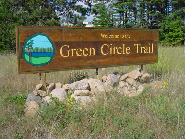
Green Circle Trail sign, Photo courtesy of Stevens Point CVB
Destination Information
County: Portage County
Type: Natural
Activities: Bike Trail, Bird & Wildlife Viewing, Cross-Country Skiing, Featured, Hiking Trails, Parks
Website: Destination Website
Property Managed By: Portage County Parks Department
Length: 26 miles
Coordinates: 44.54129, -89.56539
Additional Files:
Green Circle Trail Map
Google Map Directions (opens new window)
More destinations in Portage County
Last Verified: 2026-10-20
Did we miss something? Please contact us with any corrections.
Nearby places
- Allen F. Blocher Planetarium 1.5 km
- Arthur J. Pejsa Observatory 1.5 km
- UWSP Museum of Natural History 1.6 km
- Stevens Point Sculpture Park 1.8 km
- Stevens Point: Main Street Historic District & Landmarks 2.2 km
- Central Wisconsin Children’s Museum 2.4 km